DOTA
A Large-Scale Benchmark and Challenges for Object Detection in Aerial Images
Image Source and Usage License
The DOTA images are collected from the Google Earth, GF-2 and JL-1 satellite provided by the China Centre for Resources Satellite Data and Application, and aerial images provided by CycloMedia B.V. DOTA consists of RGB images and grayscale images. The RGB images are from Google Earth and CycloMedia, while the grayscale images are from the panchromatic band of GF-2 and JL-1 satellite images. All the images are stored in 'png' formats.
Use of the Google Earth images must respect the "Google Earth" terms of use.
All images and their associated annotations in DOTA can be used for academic purposes only, but any commercial use is prohibited.
Object Category
- The object categories in DOTA-v1.0: plane, ship, storage tank, baseball diamond, tennis court, basketball court, ground track field, harbor, bridge, large vehicle, small vehicle, helicopter, roundabout, soccer ball field and swimming pool.
- The object categories in DOTA-v1.5: plane, ship, storage tank, baseball diamond, tennis court, basketball court, ground track field, harbor, bridge, large vehicle, small vehicle, helicopter, roundabout, soccer ball field, swimming pool and container crane.
- The object categories in DOTA-v2.0: plane, ship, storage tank, baseball diamond, tennis court, basketball court, ground track field, harbor, bridge, large vehicle, small vehicle, helicopter, roundabout, soccer ball field, swimming pool, container crane, airport and helipad.
Annotation format
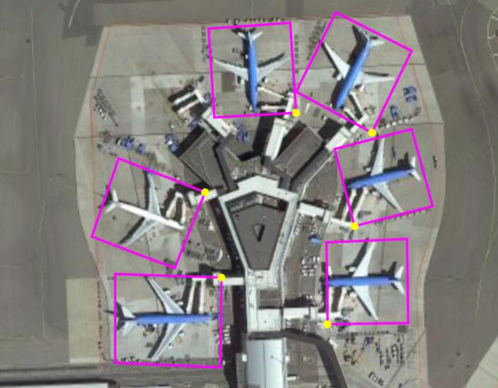
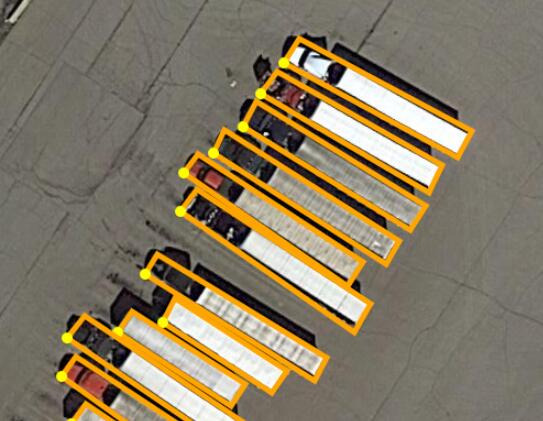
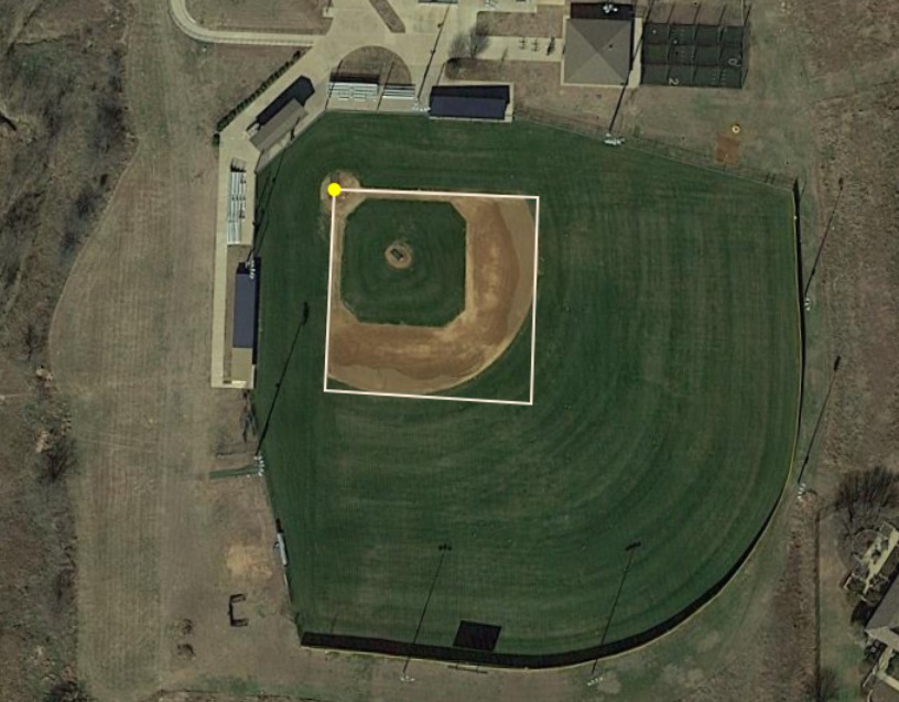
In the dataset, each object is annotated by an oriented bounding box (OBB), which can be denoted as (\(x_1, y_1, x_2, y_2, x_3, y_3, x_4, y_4\)) , where (\(x_i, y_i\)) denotes the i-th vertice of OBB. The vertices are arranged in a clockwise order. The following is the visualization of annotations. The yellow point represents the starting point, which means: (a) top-left of a plane, (b) top-left corner of a large vehicle diamond, (c) center of a baseball diamond.
Apart from OBB, each instance is also labeled with a category and a difficult which indicates whether the instance is difficult to be detected (1 for difficult, 0 for not difficult). Annotations for an image are saved in a text file with the same file name. Each line represent an instance. The following is an example annotation for an image:
x1, y1, x2, y2, x3, y3, x4, y4, category, difficult
x1, y1, x2, y2, x3, y3, x4, y4, category, difficult
...
Meta data
The meta data of image acquisition dates, image source, and GSD are provided. At the first line, 'acquisition dates' is given. At the second line, 'imagesource' (GoogleEarth, GF-2 or JL-1) is given. At the third line, ground sample distance (GSD) in meters is given. If the 'acquisition dates' and 'gsd' are missing, they are annotated as 'None'.
'acquisition dates':acquisition dates
'imagesource':imagesource
'gsd':gsd
Data Download
DOTA-v1.0
- Baidu Drive: Training set, Validation set, Testing images
- Google Drive: Training set, Validation set, Testing images
DOTA-v1.5
- Baidu Drive: Training set, Validation set, Testing images
- Google Drive: Training set, Validation set, Testing images
DOTA-v2.0
You need to download DOTA-v1.0 images, and then download the extra images and annotations of DOTA-v2.0. Note that the images in DOTA-v1.0 have been relabeled. Therefore, to evaluate your models on DOTA-v2.0, you should only use the annotations of DOTA-v2.0.
-
Baidu Drive
Extraction code: ck24
- One Drive