DOTA
A Large-Scale Benchmark and Challenges for Object Detection in Aerial Images
External Annotations on DOTA and Related Datasets
Please contact us to add your dataset here! Do not release annotations on test set images under any circumstances to keep the integrity of the DOTA challenges intact (contact us with any questions). Note: the following datasets may use DOTA data but are independent efforts not directly affiliated with DOTA.
Use of the images from Google Earth must respect the "Google Earth" terms of use.
All images and their associated annotations in DOTA can be used for academic purposes only, but any commercial use is prohibited.
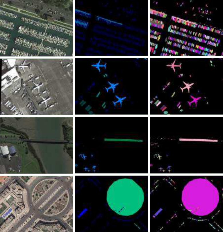
Existing Earth Vision datasets are either suitable for semantic segmentation or object detection. iSAID is the first benchmark dataset for instance segmentation in aerial images. This large-scale and densely annotated dataset contains 655,451 object instances for 15 categories across 2,806 high-resolution images. The distinctive characteristics of iSAID are the following: (a) large number of images with high spatial resolution, (b) fifteen important and commonly occurring categories, (c) large number of instances per category, (d) large count of labelled instances per image, which might help in learning contextual information, (e) huge object scale variation, containing small, medium and large objects, often within the same image, (f) Imbalanced and uneven distribution of objects with varying orientation within images, depicting real-life aerial conditions, (g) several small size objects, with ambiguous appearance, can only be resolved with contextual reasoning, (h) precise instance-level annotations carried out by professional annotators, cross-checked and validated by expert annotators complying with well-defined guidelines.